The Dutch Waterline (Hollandse Waterlinie) was a line of defence against invading armies, comprising of strategically located weirs, sluices and dikes that could inundate select stretches of land and create water barriers up to 1-metre high.
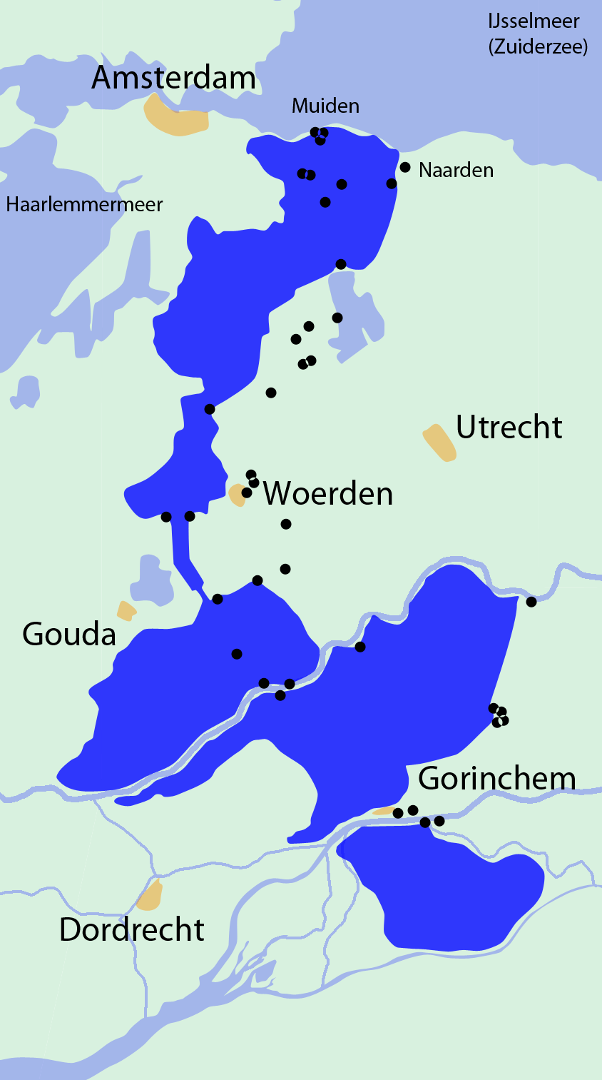
The Old Dutch Waterline was built in 1672 (left map). After trying inundation on a much smaller scale in 1589 and in 1629, a tract of was hurriedly put under water in 1672 to stop French troops’ advance during the French-Dutch wars. (This was the rampjaar, or the ‘disaster year’ for The Netherlands.) The line ran from the Zuiderzee to the Biesbosch of Muiden about Woerden, and Goejanverwellesluis to Gorinchem. The strategic city of Utrecht in central Netherlands fell outside this line as it had already been conquered. (Click on the map to zoom in)
The New Dutch Waterline
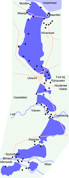
In 1815 Krayenhoff (a Dutch general and Dutch Minister of War) recommended the construction of the New Dutch Waterline (right map), also known as the Utrecht Line. Construction took place between 1816 and 1824, and then wrapped up between 1839 and 1860. (Click on the map to zoom in)
The Dutch Waterline was never put to use, even as The Netherlands was occupied twice since its construction– during the Franco-German was in 1870, and then during War World II in 1940. At present, the Dutch Waterline belongs to the Cultural Heritage Agency of the Netherlands. As a national heritage monument, is it conserved and protected by law.
  |
The following videos (in Dutch) present an animation of the Dutch Waterline and the Waterline as a natural habitat for fauna and flora species that are considered part of the Dutch Heritage.
Are such inundation lines something of the past? Not at all. In what arguably continues to be the world’s most volatile border – that between India and Pakistan – irrigation and drainage systems have a dual purpose. There is, for instance, the SCARP 6 Project near Sadiqabad – where Pakistan is at it is most narrow, where immense evaporation ponds have been created in the middle of the desert. Saline water is pumped from the deep to reduce water logging but also to create a permanent obstacle against the Indian army. Then, further South, the Left Bank Outfall Drain, the world’s largest drainage system was developed with military objectives in mind as well. Bridges across the drains, for instance, were made just wide enough to let Pakistan’ tanks pass and too narrow for the slightly larger Indian tanks. Then there was the Tidal Link canal- the seaward outlet of this large drainage system. It was constructed exactly parallel to the Indian border to thwart an onward surge of the Indian army.
Unfortunately, the direction of the Tidal Link was also that of the monsoon storms and over the years it has scoured out. As a result, the tidal effect moved 50 kilometres inland. This caused saline water ingression at high tide and wrecked ecological havoc upon the fragile brackish wetlands (dhands) in the coastal flatlands in one of the world’s poorest areas, Lower Sindh.
Do you know of more inundation lines, or other examples of water being managed in ways that serve strategic defence purposes? Please share them in the Comment section below.
Related Links:
- Official website of the Dutch Water Line: www.hollandsewaterlinie.nl/pages/the-dutch-waterline.aspx
- Information about the Geofort, a fort that is part of the Dutch Water Line and open to visitors: www.geofort.nl/en/
{jcomments on}