Posted by Frank van Steenbergen and Manoranjan Mondal
December 13, 2015
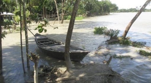
In the 1960’s and 1970’s a large part of coastal Bangladesh was converted into ‘polders’. Embankments were put up to keep protect land from tidal action and the uncontrolled flooding of the rivers. This was a major landscape change that allowed the cultivation of wet season paddy and protected houses and property from the force of nature. An estimated 1.2 Million hectares was reclaimed in these decades, a process still going on in the areas that emerge from the braiding coastal rivers and the sea, the so-called char lands.
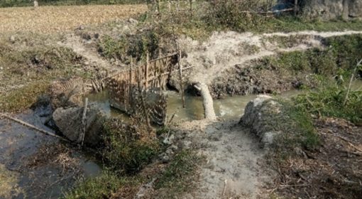
A polder typically has three elements – the embankment encircling it that keeps out the water from the surrounding river and sea, the drainage canals (natural rivers converted to canals when embankments were constructed, commonly called khal) inside the polders that remove the excess water particularly at low tide and a sluice that is opened at low tide to release the water from the polder. The sluice also doubles up as an irrigation intake during times of water shortage – for instance in the rainy season there is often a dry spell in between rainy days that can have a major effect on crop yields.
Taking a closer look, the polders are best seen as a mosaic a low-lying and high areas. The differences are subtle though – and are generally in the order of 30-50 centimeter (sometimes about a meter difference), yet this makes all the difference on what one can do in a certain area: growing paddy or cultivating fish for instance or going for a dry crop at the right time of the year.
The challenge is how to manage this patchwork of high and low-lying areas and to balance the interests of land users with high and low lands. Though this is the touch-stone of internal water management by and large little has happened in the coastal polders of Bangladesh.
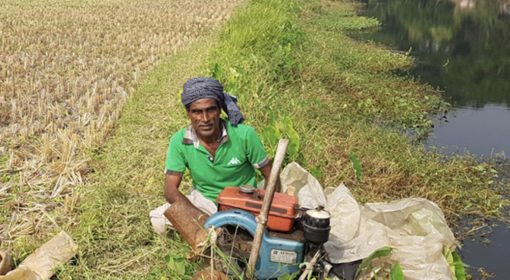
In October by good fortune two WLE (Water Land and Ecosystems) Projects met when the coordinator of the Harnessing Floods to enhance Livelihoods and Ecosystems services in Ethiopia and Sudan visited Fultala, Polder 30, Khulna, Bangladesh. In this area the ‘Community water management for improved food security, nutrition and livelihoods in the polders in the coastal zone of Bangladesh’. WLE project do not come in short words. The community crop and water management project is implemented by IRRI with a range of partners, including the Blue Gold program that works on better water management and poverty alleviation in more than 100,000 ha of land in the coastal belt.

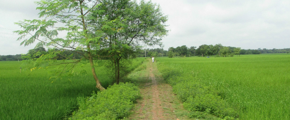
Two WLE projects meet – Manoranjan Mondal (left, Community Water Management), Frank van Steenbergen (right, Harnessing Floods) and – in between Dr Wijay social water management expert)
The activities in Fultula concerned the delineation of polder sub-units – of high and low land and the development of small drains within and between these areas. Interestingly use was also made of the ubiquitous small village roads constructed over the last years – that usually define the boundaries between the land units (there are many village roads that formed smaller units to manage water inside polder in a small scale for higher productivity of land and water). The culverts in these roads served were equipped with simple shutters and this then allowed the water to be controlled.
The controlled drainage thus created allowed a new farming system. Earlier the traditional wet season paddy (aman) was the main crop and sesame in the dry season, but in the last three years the sesame was destroyed by pre-monsoon rainfall at maturity. Farmers were hoping that the land would dry out quick enough to grow sesame early in the dry season and be harvested safely. In most previous years however this never happened.
Yet with better internal water management water levels can be controlled and two subsequent crops of high yielding rice can be grown, increasing production at least two-fold. In Fultula the changes were driven by the Water Management Groups set up with the help of the Blue Gold Program. These groups have a wide agenda – from O&M to promoting local economic development.
The improved drainage system and the higher value cropping system go hand-in-hand. By making drains around the plots for instance, water can be drained during the panicle setting and flowering period. At this time the uptake of fertilizer is very important. However if the land is inundated the costly fertilizer is washed away – so the water is then better drained out at this period.
What is being done in Fultula hopefully is the shape of things of things to come: managing water within the polders. Improved internal water management can take many forms depending on the polder: controlling water levels in both high and low lying areas; ensuring timely drainage to free up land for a dry season crops; supplementary irrigation to ensure yields in the kharif (aman) season; creating fresh water storage in khals and ponds. The in-polder water management is strongly linked to the production systems and can contribute to increased production or the cultivation of an additional crop.