Using hydrological modelling to improve drainage in Polder 26, Bangladesh
Posted by Flavia Simona Cosoveanu, Anisul Haque, and Marta Agujetas Perez
March 30, 2018
Internal roads in polders change the natural drainage patterns and direction of flow in waterways. Roads determine the water distribution and availability inside polders, and can also lead to water logging.
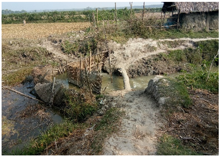
A culvert is needed here
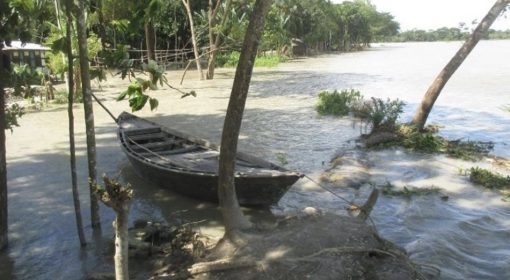
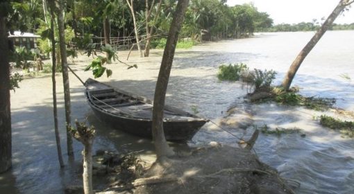
Field surveys conducted in Polder 26 in Bangladesh show waterlogging as the main problem facing communities in the Polder. The total area of the polder is 2696 ha and 85-90% of it is used for agriculture (2400ha approx.). Farmers are facing crop loss up to 70% due to water logging as seeds are washed away. Aquaculture is adversely affected by the strong water current and salinization. Moreover, field surveys reveal that water crossings such as culverts are insufficient, under-dimensioned or in poor condition due to lack of maintenance (Figure 1).
To begin with, polders were constructed without regulators to control water distribution and water levels for irrigation. On the other hand, farmers are facing water scarcity on higher grounds during the dry season. During the first stage of a recent assessment, respondents from the local community confirmed that 2 of the culverts have inadequate capacity and 10 new culverts are needed.
Bangladesh University of Engineering and Technology (BUET) together with MetaMeta conducted a comprehensive hydrological model study based on field assessments in Polder 26. The basic hydrological parameters simulated by the model were water depth and discharge in the canals inside the polder. The hydrological input to the model was an Intensity-Duration-Frequency curve where rainfall intensity was represented by 7 days continuous rainfall for a 10-year return period. The model also simulated inundation inside the polder due to waterlogging initiated by poor drainage.
By using simulated water depth and discharge in the canals, culvert sizes were determined that would be able to ensure proper drainage inside the polder. The impacts of surrounding rivers were also considered in the simulation. Thus, the hydrological modelling simulated several scenarios and determined optimal locations for new culverts, which were eventually validated with local representatives (Blue Gold, Water Management Groups, Local Government and local engineers-BWDB/LGED). Blue Gold funded the construction of 5 culverts and MetaMeta 2 culverts. Figure 2 and Table 1 present the drainage improvement once the 7 culverts are implemented.
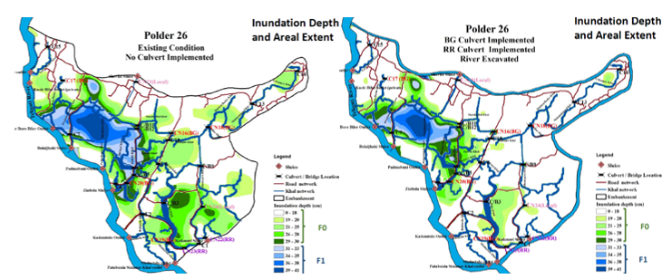
Drainage scenarios in Polder 26 without (left) and with (right) construction of gated culverts
The results show that improved drainage will decrease waterlogging significantly. Areas with high water levels (F1:31-90cm) decreased by 287%. Less inundated areas with lower water levels (F0:0-30cm) increased by 157% ; thus making more area available for agriculture. Moreover, the duration of drainage was also reduced by 10 days in the low-lying areas. If the problem of water logging is solved completely, farmers can practice multi-cropping (70% Boro/Aman rice, vegetables, watermelon and sesame), increasing agricultural productivity by 300%.
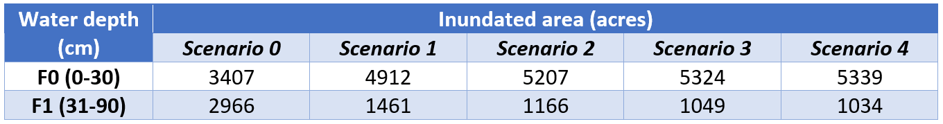
Various drainage scenarios before and after provision of cross-drainage on polder roads
The results from the modelling exercise prove that roads can be turned into instruments of polder water management. Providing regulation structures at water crossings results in multiple benefits to the rural communities such as reduction in waterlogging, increase in agricultural productivity, creation of opportunities to diversify crops, improvement in communication and local livelihoods, as well as overall socio-economic development.
 |  |  |  |
{jcomments on}